
When Traditional Survey Methods Aren’t Enough: The Value of Drone Surveying
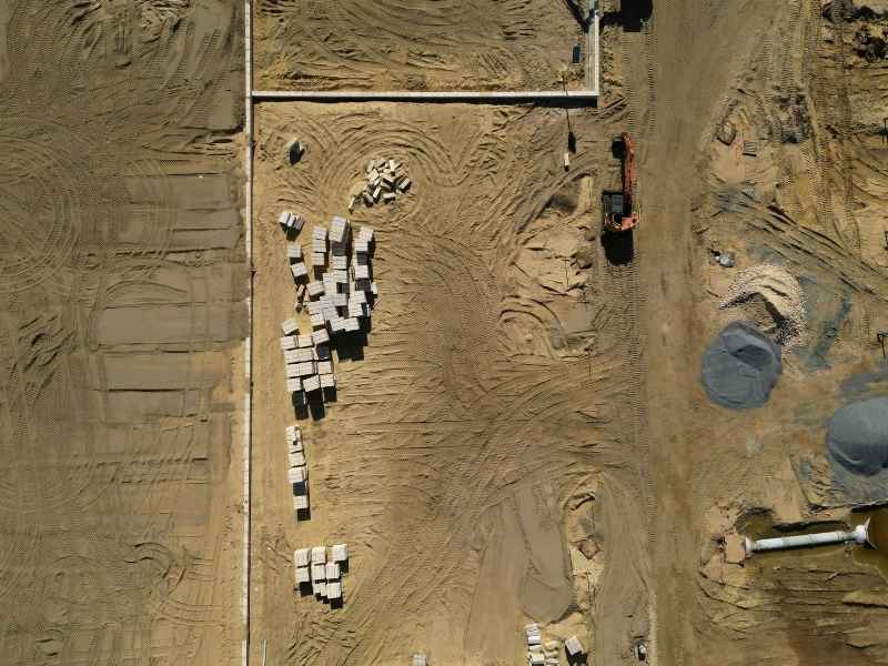
Some land is just too big or too messy to measure one step at a time. That’s where drone surveying comes in. It lets survey teams capture a wide area from above, fast, without walking every inch of the ground. For property owners, builders, and engineers working on large or complex sites, this can change how a project starts and how well it moves forward.
This article looks at when drone surveying makes sense, when it doesn’t, and how it fits alongside traditional ground surveys. No sales pitch here. Just a clear look at the tradeoffs.
When Ground-Based Surveying Becomes Difficult to Scale
Walking a site with survey equipment works well for small lots. A crew can measure corners, mark boundaries, and record elevations in an afternoon. But scale changes everything.
Picture a 200-acre farm, a quarry, or a subdivision with dozens of lots. Crews would need days, sometimes weeks, to collect enough points to represent the land accurately. Every extra acre means more time, more labor and more chances for gaps in the data.
Terrain adds another layer of difficulty. Steep slopes, wetlands and dense brush slow a crew down. Some areas might be unsafe to walk at all. And the more surface features a site has, such as culverts, fence lines, retention ponds or scattered structures, the more individual points a ground crew has to log by hand.
None of this means ground surveys are outdated. It means that once a project reaches a certain size or complexity, collecting every point on foot stops being practical.
Capturing Site Conditions That Are Hard to Understand From Individual Survey Points
A traditional survey gives you dots on a map. Each dot is accurate, but the space between the dots is a guess. On a small site, that guess is safe. On a bigger or more varied site, it isn’t.
Drone surveying fills in those gaps. Instead of a handful of points spread across acres, a drone can capture thousands of data points across the same area in one flight. That gives project teams a continuous picture of the ground instead of scattered samples.
This matters most when features interact with each other. A drainage path might run close to a building foundation. A slope might affect how water moves toward a road. These relationships are hard to see from a few isolated points, but they show up clearly in a dense, continuous dataset. Teams can spot problems before they show up during construction, not after.
Why Large or Changing Sites May Need More Complete Spatial Documentation
Some sites don’t stay the same for long. A construction site changes weekly. A mining operation shifts material every day. A large development might have crews working in one section while another section still needs planning.
For these projects, one-time measurements go out of date fast. Drone surveying makes it easier to document the whole site at once, then repeat that documentation as work continues. Comparing one flight to the next shows exactly what has changed, whether that’s stockpile volume, grading progress or new site features.
This kind of full coverage also helps when different teams need to look at the same information. An engineer, a contractor and a project manager can all work from the same up-to-date picture instead of relying on separate, older notes. And when something looks off in the aerial data, that’s often a sign to send a crew out for a closer, ground-level check.
Where Drone Data Complements Traditional Survey Measurements
Drone surveying isn’t a replacement for a licensed surveyor with ground equipment. It’s a tool that works alongside one.
Some things still require direct field measurement. Property boundaries, legal monuments and points used for official records need the accuracy and legal standing that only ground-based methods provide. High-precision elevation data, especially for drainage design or flood studies, often calls for surveyed benchmarks rather than aerial estimates alone. And any feature hidden under tree cover or inside a structure can’t be seen by a drone at all.
The strongest workflow uses both. Ground control points, placed and measured by a surveyor, anchor the drone data to real-world coordinates. The drone then fills in the broad picture around those fixed points. The result is aerial coverage that’s tied to verified ground truth, not just a photo from above.
Choosing the Right Surveying Approach Based on the Site and Required Accuracy
There’s no single right answer for every property. Surveyors weigh several things before deciding how to approach a site.
Acreage is one factor. A quarter-acre lot rarely needs a drone. A hundred-acre tract usually does. Vegetation and terrain matter too. Thick tree cover can block a drone’s view of the ground, while open fields are ideal for aerial capture. Visibility and weather also play a role, since wind, rain and poor light all affect flight quality.
Then there’s the question of what the survey is for. A boundary survey for a property sale has different accuracy needs than a topographic survey for site design. Some projects need measurements accurate to a fraction of an inch. Others just need a general picture of slope and drainage.
Finally, surveyors look at which specific features must be measured. If a project depends on exact utility locations or property corners, ground equipment stays part of the plan no matter how large the site is.
Good surveying isn’t about picking the newest method. It’s about matching the method to the site, the budget and what the final data needs to do.
Frequently Asked Questions
Can drone surveying completely replace traditional land surveying?
No. Drones are strong at collecting wide, continuous data, but tasks like setting legal boundaries or marking monuments still require ground equipment and a licensed surveyor.
When does a property become large enough for drone surveying to be useful?
There’s no exact cutoff, but drones tend to make the most sense once a site reaches several acres or has terrain that would take a ground crew a long time to cover on foot.
Can drone surveying be combined with measurements collected on the ground?
Yes. Most projects work best this way. Ground control points measured by a surveyor anchor the drone data, so the aerial results line up with accurate, verified coordinates.
What site conditions can make drone surveying less effective?
Dense tree cover, tall structures that block flight paths, and poor weather can all limit what a drone can capture. In these cases, more of the site may need direct field measurement.
How accurate is drone surveying compared with traditional survey methods?
With proper ground control, drone data can reach high accuracy for many uses. But for legal boundaries or fine elevation work, traditional survey-grade equipment still sets the standard.
