↓
 

Warner Robins Land Surveying

...an Pro17 Engineering site for Warner Robins, GA

Warner Robins Land Surveying
  • Home
  • ALTA Title Survey
  • Boundary Surveying
  • Construction Survey
  • Drone LiDAR mapping
  • Elevation Certificate
  • Land Surveying
  • Topographic Survey
  • Contact Us
Home - Page 4 << 1 2 3 4 5 6 7 8 >>

Post navigation

← Older posts
Newer posts →

What is an ALTA Title Survey?

Warner Robins Land Surveying Posted on February 10, 2020 by Land SurveyorApril 2, 2020
ALTA Title survey

ALTA stands for American Land Title Association. ALTA Land Surveys are similar to a boundary or lot survey of a piece of land. However, an ALTA Title Survey has further requirements for the land surveyor as he executes the survey because of the high-dollar value of the property.

ALTA Survey Standards Lead to Consistency

ALTA SurveyMost states have widely varying standards for surveying. Thus, ALTA Surveys follow a national standard for surveying aimed to generate consistency regardless of the location of the survey. This type land survey is usually done on a multi-family residential or commercial site and when the owner and/or lender are from different states. But more often than not, it is prepared for commercial properties because it provides the information needed in order to insure the title to the land. Commercial developments may also require improvements to a high level that is also obtained through this survey.

ALTA Title Surveys are very complex and are commonly more costly than surveys following state standards because it takes more time and effort.

Costs for such surveys could be up to 50% – 200% more than a similar boundary survey. It is also important to note that the more restrictive standard is followed in the survey if the state standard is more restrictive on a certain aspect than the ALTA standard. An ALTA Title Survey must show all data including boundary lines, main building location and all its improvements, location of ancillary buildings, rights-of-way, and easements or access rights by utility services such as water, telephone, gas, railway and other utilities. A helpful tip in outlining the scope of services of the land surveyor is to thoroughly go over the elements of “Table A – Optional Survey Responsibilities and Specifications”.

ALTA Survey Requires Title Committment

Before an ALTA Title Survey can be completed, there must be a current title commitment. This is where the land surveyor will refer for the legal description of the property and all legal encumbrances or exceptions. The areas of ownership, encumbrances, and improvements will be presented graphically including encroachments, if there is any.

All the affected parties; the buyer, seller, lender, and title insurance company must be indicated on the ALTA Title Survey certificate. The land surveyor and the title insurance company must closely work together in order to illustrate comprehensively all matters affecting the ownership of the land and improvements.

Requirements for an ALTA/ACSM Land Title Survey as detailed by the American Land Title Association, National Society of Professional Surveyors and the American Congress on Surveying and Mapping is certainly met through an ALTA Title Survey.

If we can help you with an ALTA Title Survey in the future, please don’t hesitate to contact us at Warner Robins Land Surveying at (478) 449-0555 or fill out our contact form by clicking the link.

Posted in ALTA Title Survey, land surveying | Tagged ALTA Survey, ALTA Title survey, ALTA title survey Warner Robins GA, Warner Robins ALTA Title Survey

What You Need to Know About Land Surveying

Warner Robins Land Surveying Posted on November 8, 2019 by Land SurveyorApril 2, 2020
land surveying

land surveying

What is Land Surveying?

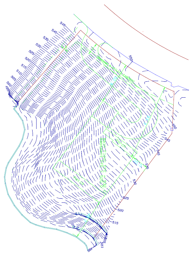
Land surveying is the art and science of accurately measuring parcels of land. Measurements such as dimensions, lengths, boundary lines, including structures within the area are all precisely determined through a land survey. These measurements are used to establish land maps, boundaries for ownership or for governmental purposes. It is a detailed study of every physical and cultural property of the land, whether above or beneath it, to illustrate it in usable form. 

 Data is gathered through observations, research, field measurements, and data analysis for establishing property boundaries. Records from previous surveys and government records will strengthen the reports made after the survey. 

What covers land surveying?

A land survey is classified according to the purpose or why the survey is being performed. Some of the common types of land survey are boundary surveys, topographic surveys, partition or subdivision surveys, flood elevation survey, property line adjustment survey, and extended title insurance coverage survey. 

Other services such as mapping, construction layout surveys, judicial surveys, registered land surveys are all part of land surveying. It is an essential element in every development of the environment especially in the fields of construction, transport, communication, mapping, and most especially in the definition of legal boundaries for ownership.

The key component in the field of land surveying is the land surveyor. A land surveyor is a person that takes charge of every activity that transpires during a land survey. It is the surveyor who makes the research and data gathering and even interpretation and analysis of all data wherein translation of all data gathered is crucial and should be checked, attested, and sworn in the law to be true and correct. It is important then for you to choose a land surveyor with the highest degree of expertise and who can assume responsibility for the complex tasks at hand. It should be emphasized that only a surveyor who has knowledge of the elements of geometry, trigonometry, engineering, mathematics, physics, and the law are expected to have the best land survey outcomes.

Land surveying – dated back in history

Land surveying is a profession as old as the Egyptian times yet its importance to the human race still lives on. It is the best method to settle disputes over land ownership, it gives a clear picture of what buildings are suited to be constructed in a given land area, and it’s a convenient way to determine the exact dimensions of real estate to be purchased or sold. 

Optimum potential of the land you own can only be defined once you have a land survey. Whether you are planning to put it on the market, or should you want to use it for commercial purposes, a land survey must back you up if ever questions regarding everything about the land arise. Land surveying will provide a sense of security and peace of mind to every land owner and even to the future buyers.

Land surveying will always be an integral part in protecting real estate and upholding of laws governing the utilization and distribution of your land assets. 


Call Warner Robins Land Surveying today at  (478) 449-0555  or fill out a contact form request for more information concerning your land surveying needs.


Posted in land surveying | Tagged Land Surveying, land surveying warner robins, land surveyor, land surveyor warner robins ga, warner robins land surveying, warner robins land surveyor

GPS and Land Surveying

Warner Robins Land Surveying Posted on March 1, 2019 by Land SurveyorApril 2, 2020
land surveying

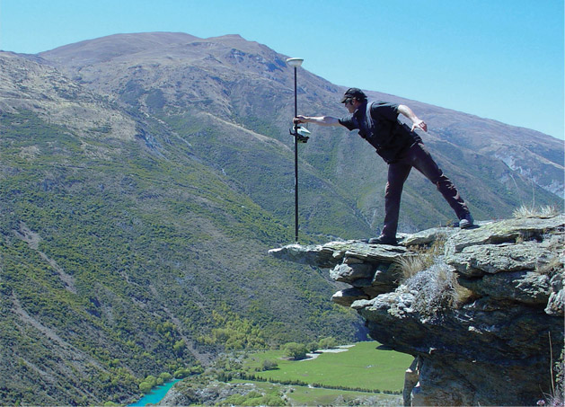
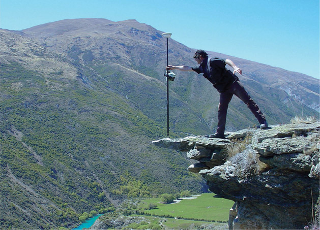
Land surveying is a profession that greatly utilize the GPS system.

land surveying

Today, man-made constellations are in orbit. Their purpose is to provide instant, exact and global positioning information. This global positioning system of GPS is revolutionizing the modern construction sites, automating and guiding land surveying equipment, providing instantaneous circles and volume gap, simplifying total and controlled surveys. Nearly everyone involved in the land surveying and construction industry has heard something about satellite positioning technology or maybe you or someone you know is already using it. Whether an operator or a casual observer, there are still many questions about how this exciting system really works.

These positioning satellites don’t stay in one place like the stars; they orbit the earth about twice a day. Constantly transmitting uniquely identified radio signals that can be perceived by specialized units on earth. These signals are used to precisely measure the distance to the receiving instrument from each satellite visibly overhead.

Just as stars have exact locations in the sky, the locations of the GPS satellites are also defined, becoming orbiting reference points. Using a process based on triangulation, a GPS receiver processes the signals from multiple satellites to compute an accurate position on Earth, which is why it is widely use in land surveying.

For mobile applications that require high accuracy, such as three dimensional machine control, there are two requirements that must be met. First, the signals from a minimum of five satellites must be received at all times. And second, those five satellites must be distributed across the sky. This is called Dilution of Precision or DOP. The simple rule of thumb is this, the more satellites received the better your system will perform.

land surveying

All land surveying receivers incorporate standard GPS tracking technology; unfortunately the GPS satellite constellation alone cannot continuously make the minimum requirement of accurate mobile positioning. For any given location, there are times in a day when there are less than five available satellites or very poor DOP.

Now, consider a land surveying job site with trees, buildings, or other obstructions when satellite receptions are easily be further reduced. All land surveying GPS receivers suffer this same problem because they all use the same satellites to operate.

Even the planned signal modernization to the GPS satellites won’t solve this problem. An obstruction that blocks one signal blocks all signals from that satellite. A land surveying equipment provider has solved this problem. The solution isn’t adding more signals from the same satellites; it’s adding more satellites.

Today, there is a second positioning satellite constellation in operation, the Glonass System. This positioning system is operated and maintained by the Russian government; much like the GPS is operated and maintained by the United States government; combining these two satellite constellations give land surveyors access to 38 different satellites; 14 more than a GPS-only system.

The additional satellites mean stronger and more accurate positions and better performance in obstructed land surveying areas. These additional satellites mean maximum up time in all land surveying locations, in all conditions.

For an up to date and accurate land surveying service, contact Warner Robins Land Surveying at (478) 449-0555 or better yet, you may fill out our contact form request and a licensed land surveyor will contact you. 

Posted in GPS, land surveying | Tagged GPS land surveying, GPS land surveying Newnan, Land Surveying, land surveying GPS, land surveying warner robins, land surveyor, land surveyor warner robins ga, Warner Robins GPS land surveying

Post navigation

← Older posts
Newer posts →
Get Quote Button
© Boxer Survey USA
Boxer Survey USA
Warner Robins Land Surveying

Warner Robins, GA
Phone:(478) 449-0555

Web Development and SEO by:
AuburnBusiness.com, LLC


Privacy Policy | Terms of Use

The owner of this website, Boxer Survey USA, provides coordination of professional land surveying and engineering services in all 50 states. The professional surveying and engineering services provided to you will be conducted by fully licensed professionals in your state.

↑